Economic Development
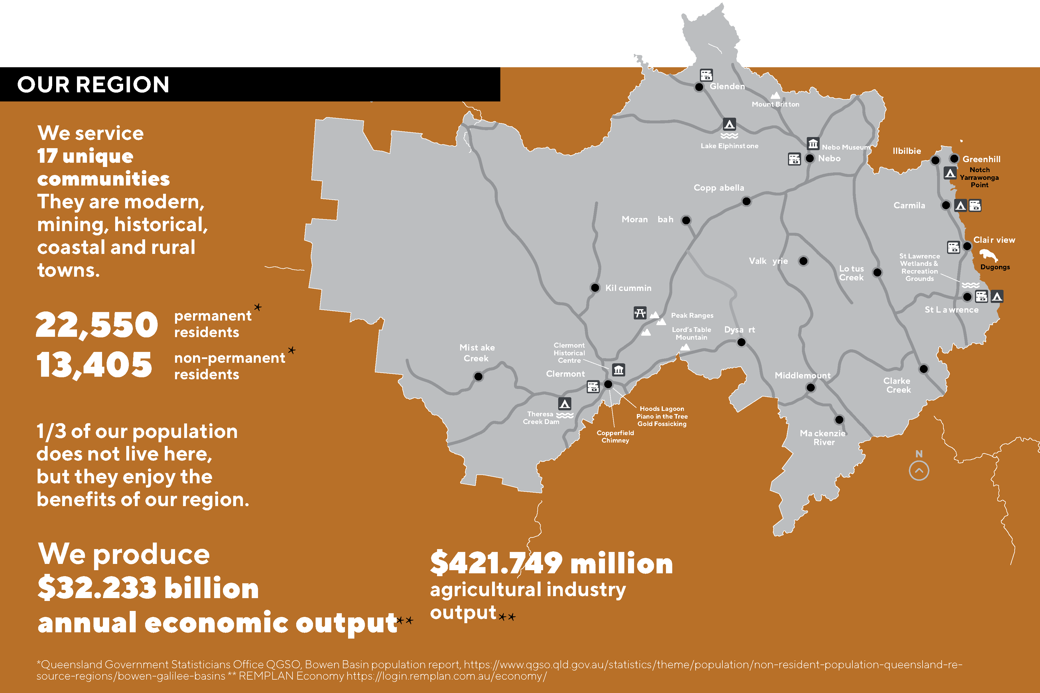
Isaac Regional Council’s economic development team provides specialist functions to support the continued social and economic development of the Isaac region and its significant economic contribution to the broader regional state and national economies.
Council provides a range of specialist assistance and professional services for local, national, and international businesses to help navigate government requirements.
Services we can provide:
- Business case development support.
- Starting or growing a business.
- Business approvals and licences.
- Customised site selection assistance.
- Incentives and assistance.
- Access to economic indicators, publications and strategy.
To read the full document >>> Invest in Isaac(PDF, 6MB)