The Bicentennial National Trail
The Bicentennial National Trail is the longest marked, non-motorised, self-reliant multi-use trekking route in the world.
It stretches across an extraordinary 5,330 kilometres from Cooktown in tropical North Queensland, through the east coast of the Isaac region, right down to Healesville in Victoria.
Following the inspiration of the legendary bushman R. M. Williams, the trail follows the historic coach and stock routes, old pack horse trails, and country roads.
Wherever possible along its great length the trail has been designed to be a living history of our country, following the routes of our early pioneers and highlighting historic sites and artefacts along the way.
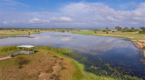
As it winds virtually the length of the country, the trail links 18 National Parks, and reveals some of the most spectacular scenery in Australia.
It traverses lush tropical rainforests, rugged mountains, valleys and gorges, remote dry plains, alpine meadows, snowfields and wilderness.
The trail gives access to some of the wildest, most remote country in the world and provides endless fascination for those interested in Australia's unique fauna and flora.
The trail is broken in to 12 sections, the Isaac region is Section 3 – Collinsville to Kabra.
Following this trail will lead you through the little used wagon road over Connors Range to the coast of St Lawrence.
Crossing saline flats and following stock routes along the Fitzroy River can be planned with most forms of travel.
Remember your camera, there are sights you won't want to forget.
BUY TRAIL MAPS
The National Trail is now replacing its Guidebooks with accurate A3 styled downloadable maps with a GPS track-lines product to be loaded onto various navigation Apps. Go to their map store.
For more information visit the National Trail website to plan your trek.